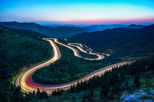
Autori Road Imaging
Capture the road. Build better visual information.
Collect high-quality, location-based imagery from your road network using the collection method that best fits your needs.
Autori Road Imaging supports still images, 360° imagery and drone imagery, helping road authorities, municipalities and contractors build reliable visual datasets for road maintenance, documentation and further analysis.
Trusted since 1988
- 35+ years of road maintenance expertise
- 10,000+ active users
- 100,000+ km of roads managed
- Long-term partnerships with road maintenance organizations
Road Image Collection Built Around Your Needs
Different road networks and use cases require different approaches to image collection.
Autori Road Imaging brings together the technology, processes and expertise needed to collect road imagery efficiently and consistently—from continuous collection during everyday operations to dedicated 360° and drone imaging projects.
Choose the collection approach that fits your road network, objectives and required level of detail.
Everything your image collection teams need
Plan image collection projects efficiently.
-
Create image collection projects
-
Divide projects into manageable road segments
-
Import projects through APIs or import tools
-
Assign operators to planned routes
Coordinate image collection in the field.
-
Assign road segments to operators
-
Navigate using the mobile app
-
Follow completed routes
-
Monitor operator locations in real time
Document image collection activities.
-
Record completed routes
-
Verify image quality before project completion
-
Maintain reliable project documentation
Monitor image collection projects in real time.
-
Compare planned and completed segments
-
Track project progress
-
Record driven kilometres
-
Record working hours
Manage unexpected situations during image collection.
-
Record deviations using dedicated forms
-
Document roadworks and restricted access
-
Register inaccessible roads
-
Maintain complete operational documentation
Monitor image collection performance.
-
Interactive maps
-
Operational dashboards
-
Advanced search
-
Project reporting
-
Management reporting
Choose the collection approach that fits your road network, project and operations.
-
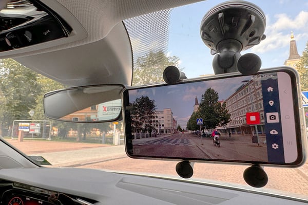
Still image collection with Autori Vista App
-
360° image collection
-
Drone image collection
-
Flexible collection for different projects and operational needs
Three Ways to Capture the Road
The right imagery at the right stage.
Different stages of road maintenance can call for different types of imagery. At the start of a new maintenance contract, comprehensive 360° imagery can be used to establish a detailed visual baseline of the road network.
During everyday operations, still images can then be collected regularly to build a continuous stream of up-to-date visual information. Drone imagery can complement road-level collection when a broader aerial perspective is needed.
This gives you a much stronger lead-in to the three cards:

Still Images
Collect location-based still images with Autori Vista App from vehicles travelling the road network. Ideal for frequent, high-volume image collection as part of everyday operations.

360° Imagery
Capture a comprehensive road-level view of the road and its surroundings. Particularly valuable for establishing a detailed visual baseline at the beginning of a maintenance contract or other large-scale documentation need.

Drone Imagery
Capture roads, infrastructure and surrounding areas from above. Drone imagery complements road-level collection when a wider perspective provides additional value.
Make Image Collection Part of Everyday Operations
Collect more without creating more work.
Road imagery becomes increasingly valuable when it can be collected regularly and consistently.
With Autori Vista App, still-image collection can be incorporated into vehicles already travelling the road network. This allows organizations to collect imagery alongside normal operations and build a continuously growing visual dataset.
360° and drone imagery can complement regular collection when more comprehensive or specialized imagery is needed.
Plan Image Collection Around the Purpose
Start with what you want to achieve.
Successful road imaging starts before the first image is captured.
Collection frequency, coverage, image type, positioning, image quality and collection equipment should all be considered according to how the imagery will ultimately be used.
Autori helps organizations design an image collection approach that fits their road network, operational requirements and intended use of the imagery.
Why Organizations Choose Autori Road Imaging
Autori Road Imaging combines flexible collection methods with practical road imaging expertise to help organizations build reliable visual datasets from their road networks.
Choose the Right Imagery
Use still images, 360° imagery, drone imagery – or a combination of different approaches—depending on your collection needs.
Collect During Everyday Operations
Use Autori Vista App to collect still images from vehicles already travelling the road network and make regular image collection part of normal operations.
Cover Large Road Networks
Plan repeatable image collection across extensive road networks while maintaining a consistent approach to the collected visual information.
Improve Collection Consistency
Establish clear collection practices for coverage, frequency and image quality so that imagery remains useful and comparable.
Match Collection to the Use Case
Choose collection methods according to what you need the imagery for, from regular road documentation to specialized imaging projects.
Build a Foundation for Further Use
Create a reliable visual dataset that can be used with other Autori capabilities. Collected imagery can be brought into Autori Vista for viewing and utilization, while suitable imagery can also support AI Image Detection.
Expertise Behind the Image Collection
More than cameras and images.
Successful road image collection requires an understanding of both the technology and the road environment.
Autori has extensive experience in road image collection and visual road information. We help customers consider collection methods, equipment, coverage, frequency, image quality and operational processes.
Our expertise can support anything from establishing an ongoing image collection process to planning larger or more specialized road imaging projects.
Talk to Our Road Imaging Experts →
From Collection to Visual Road Information
Use the right level of analysis for the job.
Collecting imagery is the first step.
Once imagery has been collected, Autori Vista provides the environment for viewing and utilizing visual road information. Users can review imagery and manually identify and document observations when human assessment is the most practical approach.
When image volumes become large, AI Image Detection can automate the identification of selected road defects, objects and maintenance needs. This is where automated detection brings the greatest value—processing large volumes of suitable imagery efficiently and consistently.
The goal isn't to automate everything. It's to use automation where it creates real value and manual analysis where it makes more sense.
Autori Road Imaging
Collect the imagery.
Autori Vista
View, utilize and manually analyze it.
Autori Intelligence - AI Image Detection
Automate analysis at scale.
Explore Autori Vista →
Customer result
Road maintenance organizations use Autori One to connect work management, road imagery and operational intelligence in one platform, improving efficiency, documentation and decision-making.
Uses Autori to Improving Operational Visibility Across Daily Road Maintenance
Read More

Frequently Asked Questions
Autori Road Imaging supports still images, 360° imagery and drone imagery. The methods can be used separately or together at different stages of road maintenance.
For example, comprehensive 360° imagery can be collected to establish a detailed visual baseline at the beginning of a maintenance contract, while still images can be collected regularly during everyday operations. Drone imagery can complement road-level collection when a broader aerial perspective is needed.
Not necessarily. Still images can be collected with Autori Vista App from suitable vehicles already travelling the road network, allowing image collection to become part of normal operations.
360° and drone imagery may require dedicated equipment or collection services depending on the requirements of the project.
Collected imagery can be brought into Autori Vista, where users can view and utilize visual road information and manually review imagery, identify observations and document findings.
When image volumes become large, AI Image Detection can automate the identification of selected road defects, objects and maintenance needs.
This allows organizations to use manual review where it makes sense and automated detection where the volume makes automation most valuable.