Utilizing 360-degree and 2D images in the initial phase of a road and street contract offers valuable visual insights for planning and decision-making. Discover effective and cost saving ways to leverage these images, including:
1. Initial assessment
Conduct a thorough evaluation of the contract area using 360-degree and 2D images. Gain a clear understanding of existing conditions, such as road layout, buildings, and utilities, to identify potential challenges and constraints.
2. Design and visualization
The value of image data will become clear when you can fully harness the power of images in the planning and design phases of different maintenance or road construction projects. This visualization helps to identify potential design conflicts and issues at an early stage.
3. Stakeholder communication
Engage stakeholders, such as local authorities, residents, and businesses, by sharing 360-degree and 2D images. This facilitates effective communication, enables stakeholders to comprehend the project scope, visualize proposed changes, and gather their feedback, thereby reducing misunderstandings.
4. Environmental impact assessment
Analyze images to evaluate the potential environmental impact of the project. Factors such as tree coverage, drainage patterns, and proximity to sensitive areas can be assessed, enabling identification of areas that may require mitigation measures.
5. Safety analysis
Utilize images to perform a comprehensive safety analysis of the project area. Identify existing road conditions that pose safety risks and design appropriate measures to address them. Analyze intersections, pedestrian crossings, and traffic flow to ensure optimal safety for all road users.
6. Project documentation
Document the project's progress by capturing regular 360-degree and 2D images during the construction and maintenance process. This documentation serves as evidence for contractual compliance and provides valuable information for future reference and audits.
7. Maintenance planning
Optimize maintenance activities and budget allocation by using images to identify potential maintenance or repair needs in the existing infrastructure.
8. As-built documentation
Capture final 360-degree and 2D images upon project completion to serve as comprehensive as-built documentation. These images can be referenced for future maintenance, inspections, and reference purposes.Incorporating 360-degree and 2D images in the initial phase of a road and street contract yields a comprehensive visual understanding of the project area, strengthens stakeholder communication, supports design and decision-making processes, and aids in project documentation and maintenance planning.
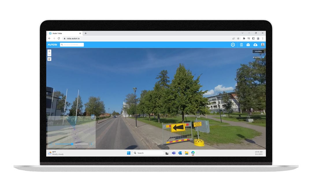
See how our Vista image viewer and Field Tools maintenance and management software could help you to achieve your contract requirements faster and safer. You can read more on the topic at this article on our blog.
Follow us also on social media
