Some of the top features
Vista has all the features you need for road and street maintenance or infrastructure maintenance.
Store wide range of images
Store images that have GPS-data and view them anytime on a regular web browser.
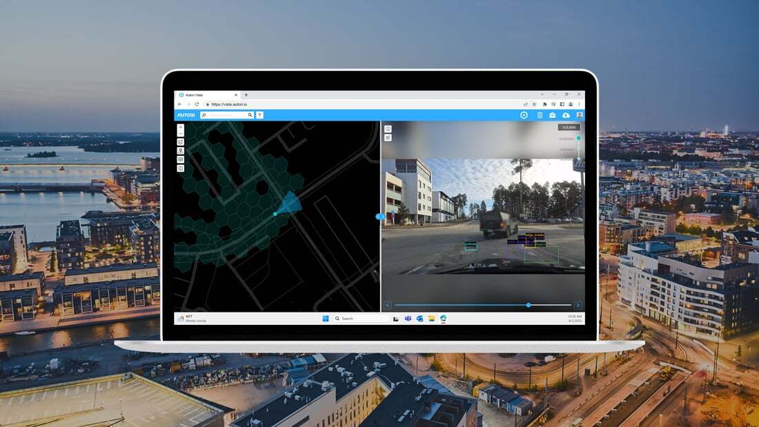
Images in daily work
With integration to Autori Field Tools, Vista can be utilized in the maintenance and planning operations of roads, streets and other infrastructure.
View and publish images
Map-based viewer lets you see and explore roads and any kind of infra that has been captured. Upload images to the cloud and publish to a variety of viewing services.
+ many more
Book a free online meeting with us to see all of the revolutionary features.
Be ahead of your competitors
Our Vista image viewer is ahead of its time. Combined with our Field Tools applications the possibilities are limitless.

Infrastructure maintenance and asset management
Image-based damage detection and asset management to boost efficiency and operational safety.

Images as a baseline
Images can be used as initial information in road and street maintenance and work planning. They are useful for remote diagnosis of affect issues, reducing costs, carbon footprint and enabling faster decision-making.

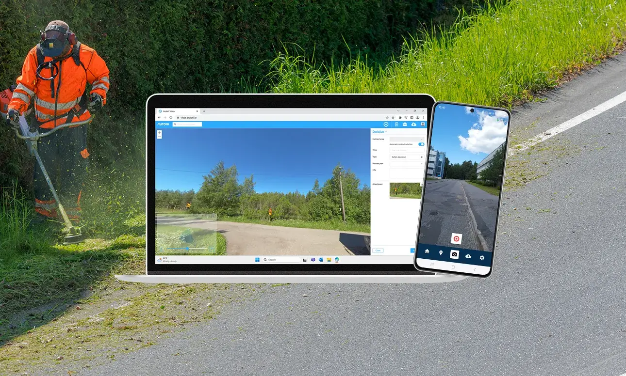
Assignments from images
Easily create assignments and work orders from images. You can crop a portion of a 360-image or add the whole image as an attachment with location info.
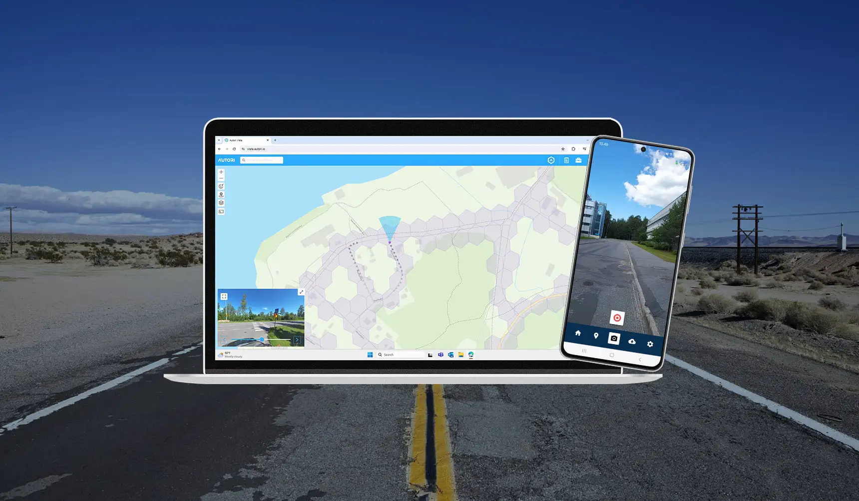
Works perfectly on mobile devices
-

Browser-based and fast
Save virtually any image with location data and create actions based on them.
-

Private image viewer
Browse images privately and create necessary actions based on the images or location.

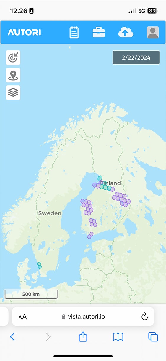

Millions of images stored
We have stored over a million images and the amount is growing every day. Join us now for a smarter outcome.