Do you utilize images in asset management? Would you value the possibility to make work related decisions based on images on the road network or other remote infrastructure? Autori enables all this in a very user friendly way. Check it out yourself!
Autori Field Tools provides powerful and easy to use tools to manage work related to infrastructure maintenance. We at Autori have a wide arrange of experience of road and street related solution base which has been developed over the years together with local authorities, contractors and consultants.

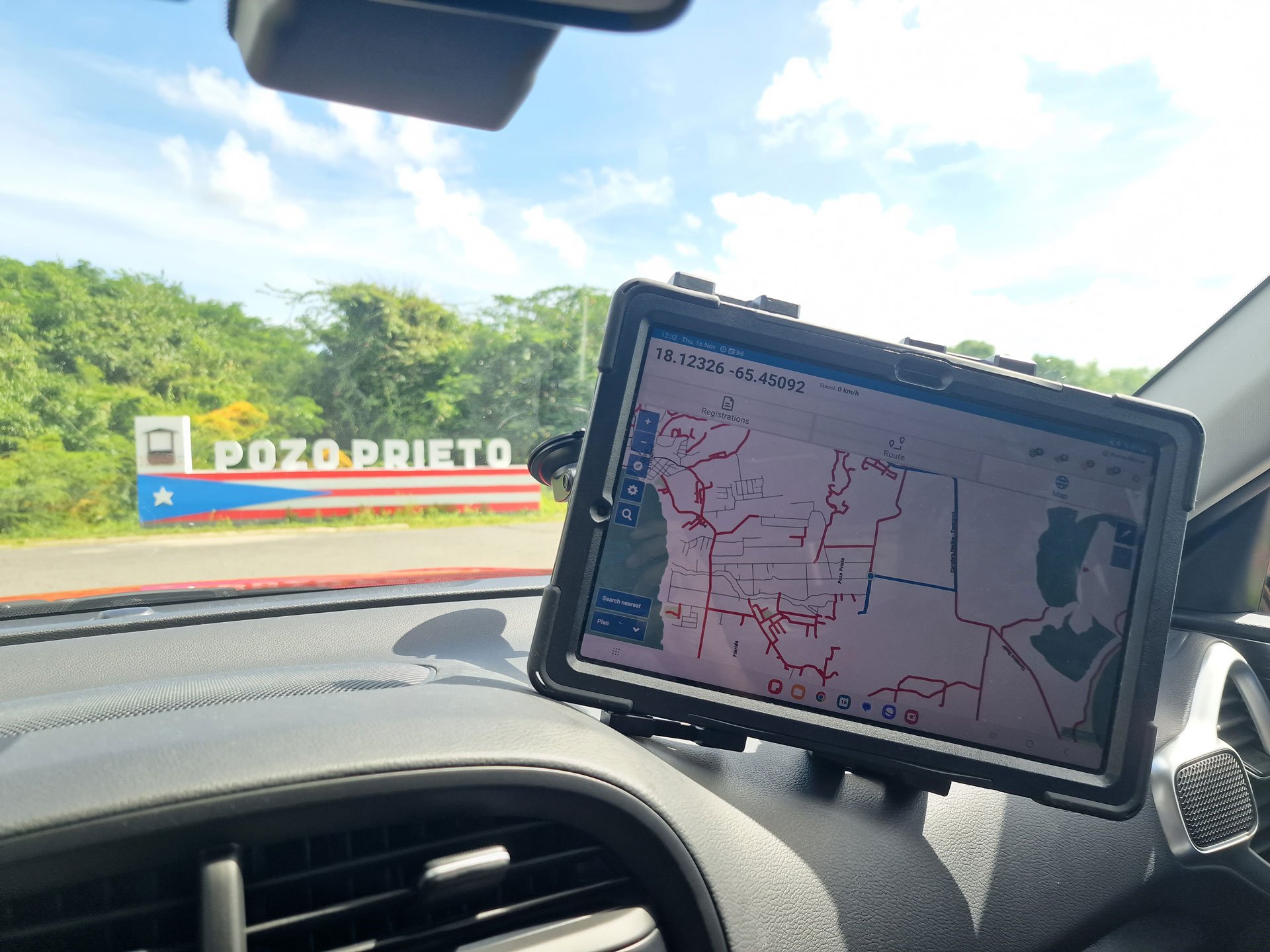
Photo 1. Autori Field Tools and its tools for work management were recently used in a project in Puerto Rico.
Field Tools consists of a web app called Office, primarily for desktop-PC usage and a mobile app for people who need to be present in the field making observations, reports and other registrations provided by the app. Typical use cases of Field Tools are:
- Office
- Managing work: create work orders, supervise
- Creating reports: create reports from all of the date collected by your Field Tools users
- Monitoring development: monitor on-going and finished work on real-time dashboards
- Mobile app
- Creating registrations: mark work as done
- Saving routes: start and end specific work routes that have been created in Office for different work types
Nothing beats the combination of Field Tools and Vista
Now we have made our platform even stronger. We have added Autori Vista in the portfolio enabling heavy use of image data in connection with work management. Whenever you want to utilize 360-degree images or still images, Autori Vista is the right choice. Image data management and utilization has never been this smooth and easy!

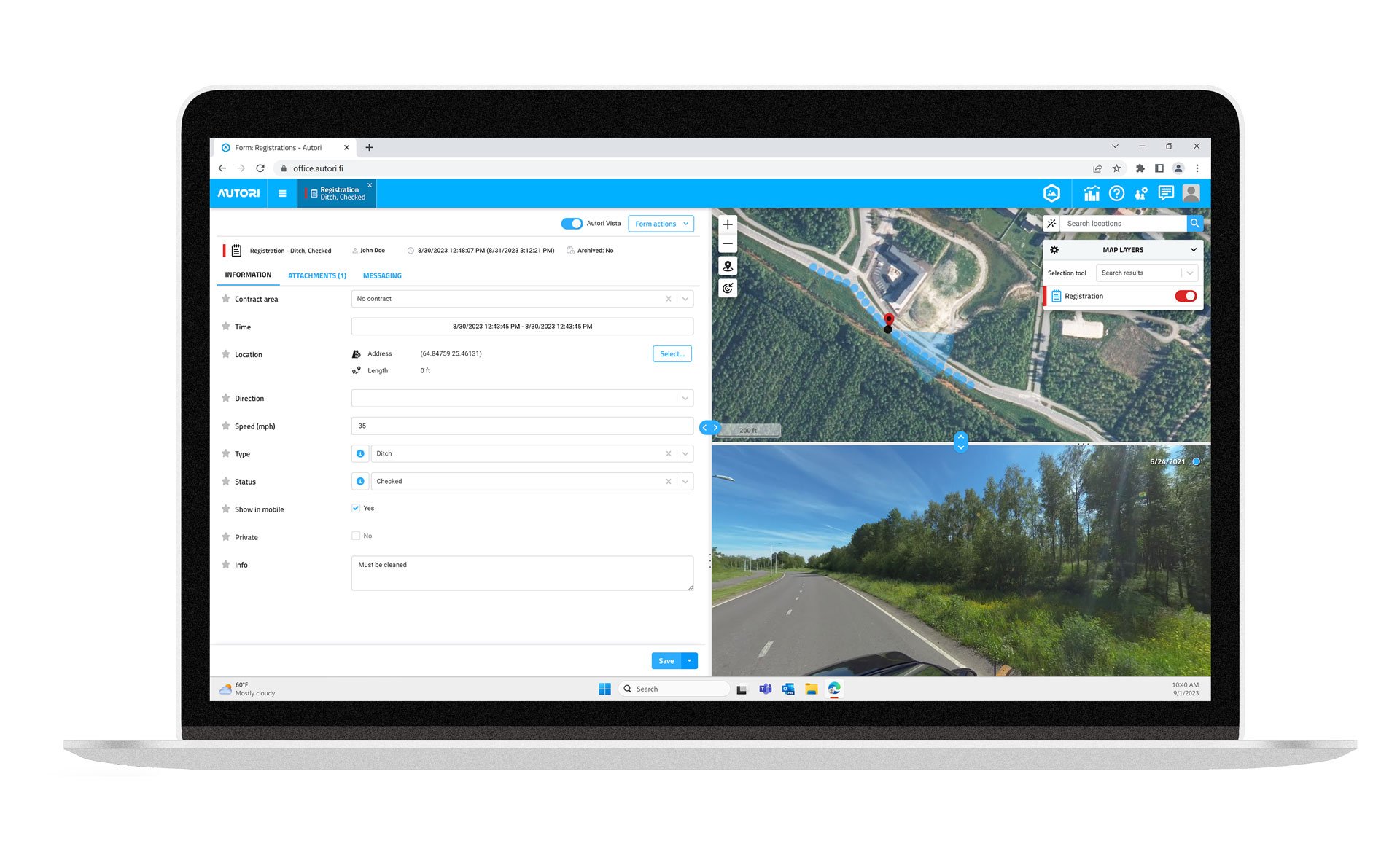
Photo 2. Field Tools with location-based images from Vista.
It is convenient to create location-based registrations from the field. Now imagine that combined with images. We offer a convenient way to combine 360-imagery with registrations and AI-powered defect inventory from road images. You can quickly check out the location of an observation created from the field and also its surroundings, making it easier for you to address the issue with correct measures.
Supports:
- 360-images
- Still images
- Drone images
Vista is a secure and private service, where your images are safe and available at any time. Whether you need to create an inventory of roadside assets in 360-images or save before and after images of routes related to a contract area, Vista is the perfect tool.
Nothing is more convincing than being able to prove before and after situations in actual images from the scene. Our platform is adabtable and suitable for many different use cases. We will gladly assist in any inquiries and work out the best solution for you.

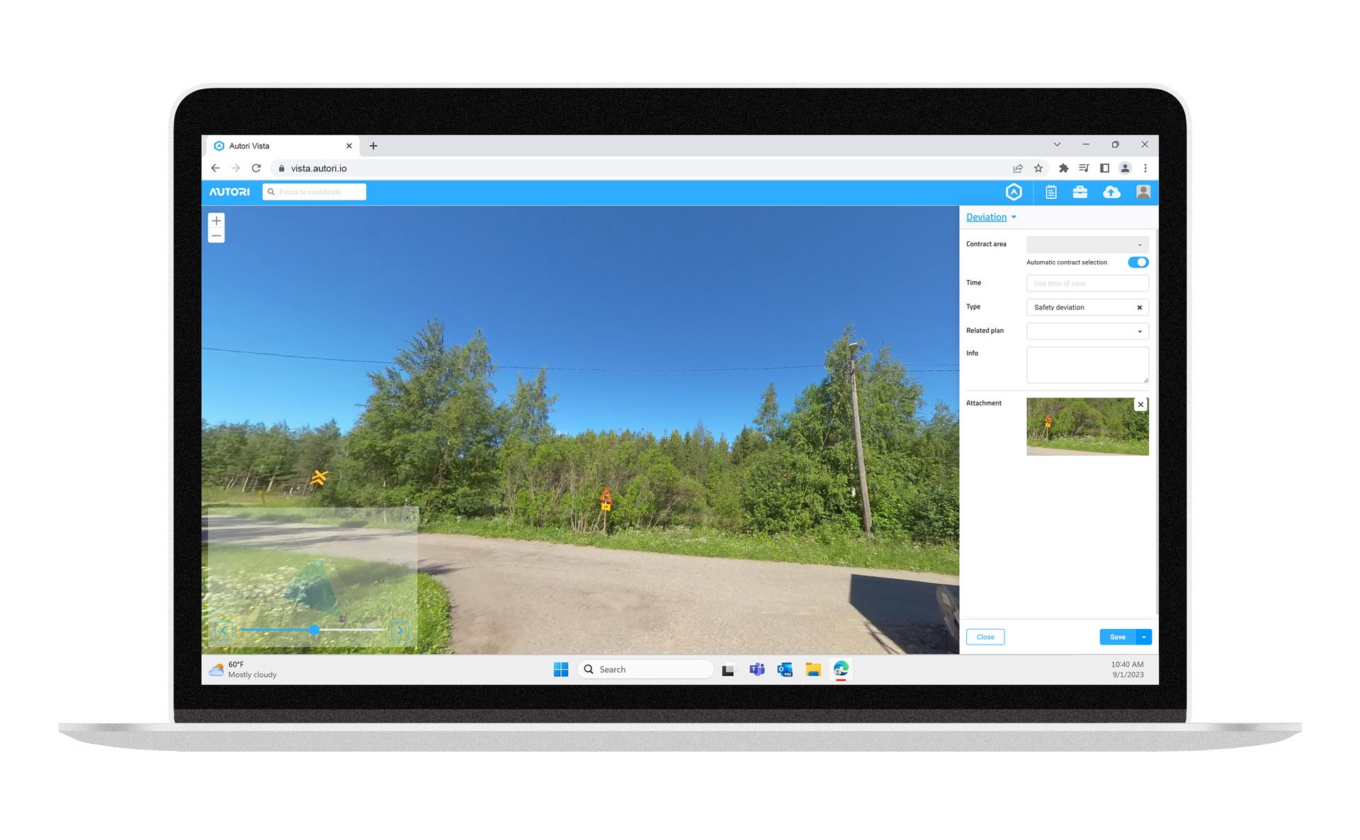
Photo 3. An example of how to create observations from 360-images. In this case, a deviation of a planned route for 360-images is being created.
Experience the difference that our platform can make in your business! If you are interested in hearing more about our solutions, please do not hesitate to contact us!
More about our solutions: https://autori.io/solutions
Autori Field Tools: https://autori.io/field-tools
Autori Vista: https://autori.io/vista
Dec 7, 2023 1:58:17 PM